


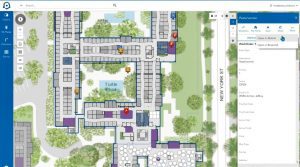


From the management of underground assets—like pipes, valves, and meters—to automatic hydrant inspection to efficiencies in our billing system, GIS can help increase the quality of service your water utility provides every day.
Central Arkansas Water has been a Cityworks user since 2008 and an Esri user since 1996. They recently wrote an article for Esri News for Water highlighting how their use of these two platforms has grown across their entire organization.
“GIS provides a lifeline from the workers in the field to critical information to help them on a daily basis, whether it’s being able to quickly locate a valve, isolate a main break, or to find a meter to assist a customer. GIS enables us to have this information literally at our fingertips.”
Comments (0)