Manage your work. Anytime. Anywhere.
You need to provide sustainable services to your customers while maintaining assets in a cost-effective manner. Cityworks AMS is designed to help you manage public assets and their associated data, work activities, and business processes.

The GIS-Centric Platform


Use the ArcGIS geodatabase as the authoritative system of record for all asset classes—linear, dispersed, and condensed.
Take advantage of well-known data structure elements to integrate Cityworks with other business systems.
Support your organization throughout the entire asset management workflow: from data collection and work management to regulatory reporting and strategic planning.
Use ArcGIS tools for simple and effective location intelligence, supported by web maps and single sign-on access to Esri apps and analytics solutions.
Cityworks + ArcGIS
Cityworks is the leading GIS-centric platform for public asset management.
Access Real-Time Data
Cityworks is built exclusively on ArcGIS, giving both office staff and field crews access to real-time data and simplified workflows.
Make INFORMED Decisions
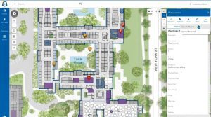
Use dashboards, analytics, and maps to visualize data, understand resources, and report more accurately.

Improve Collaboration
Share asset data and streamline communication among employees, across departments, and with your customers.
Identify and Evaluate Risk
Cityworks and ArcGIS can help you identify your riskiest assets and put the right plans in place to improve them.

MOBILIZE YOUR WORKFORCE
Empower your field crews to interact directly with GIS assets by collecting information, reporting observations, uploading pictures, completing outstanding tasks, and using visual map tools to streamline workflows.
TARGETED SOLUTIONS


learn more

3 Webinars or Virtual Events to Catch This Month
The weather is hot, but the learning opportunities are even hotter! Check out this list of three free webinars or

Turning Your Cityworks Inbox into a Management Dashboard
Integrating Microsoft Power BI with Cityworks can help utilities easily interpret key information about their assets. In the area of

4 Webinars or Virtual Events to Catch This Month
Looking to learn something new this month? Cityworks has got you covered! Check out this list of four free webinars

DigEplan Joins the Cityworks Partner Network
DigEplan, a global leader in fully integrated electronic plan review, is the latest solutions provider to join the Cityworks Development

Industry Insights from Damian Spangrud of Esri
As director of solutions at Esri, Damian Spangrud focuses on making the science of location intelligence understandable and actionable. We

Avolve Software Joins the Cityworks Partner Network
Cityworks is pleased to welcome Avolve Software to our Development Partner network. Together with Cityworks PLL, Avolve’s ePlan Life Cycle

4 Reasons for Wastewater Operations to Use the Cloud
This article is republished with permission from WinCan. Be sure to check out their Cityworks-WinCan integration, which is 100% cloud

Tracking and Approving Private Construction Development Projects with Cityworks + ArcGIS
What if? It’s a question that’s often posed but rarely answered. For Spotsylvania County Utilities Department, however, the answer to


