Planning and Community Development
Transparency and Accountability
Cityworks PLL—permits, licensing and land—gives planning and community development agencies direct control of their business processes. Designed to simplify applications for customers and streamline workflows for staff, Cityworks PLL helps you deliver better service to your community.


The Power of GIS
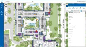
Built exclusively for Esri’s ArcGIS®, Cityworks uses your geodatabase as the authoritative system of record for all land and asset information—improving the reliability of addresses, parcels, and land layers. Map layers can display current projects as they are tied to a parcel or building, and public dashboards improve transparency and accountability.
Improve Communication
Our unique template design allows organizations to set up as many templates as they need to manage their specific business processes. Cityworks lets you connect multiple departments, track project status, and attach associated documents to each case. Cityworks eliminates the need to transfer documents from one department to another.


Fully Integrated
Cityworks PLL integrates seamlessly with the Cityworks Asset Management System, offering a unique enterprise solution built upon Esri ArcGIS. Use PLL and AMS to track the full life cycle of public assets across your organization and achieve greater collaboration between all departments.


